I don't know about the others on the walk, but my knees ache this morning!
Here are a few photos of our walk

We all set off in eager anticipation of what lie ahead for us


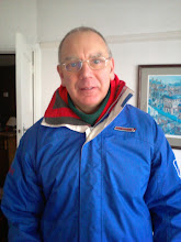
Our leader having second thoughts about what he'd let us in for?

And when we have scrambled to the top he checks that we are still on the right route - thankfully we are!

Kinder Scout is a moorland plateau (and mountain) in the Dark Peak of the Peak District. Part of the moor, at 2,087 feet (636m) above sea level, is the highest point in the Peak District and the highest point in Derbyshire. It is named after the village of de Kinder which once lay on the slope of the peak and was included in William I's Domesday Book.

In 1896 the scenery of Kinder Scout first inspired working-class ramblers from the industrial cities of Sheffield and Manchester to trespass over its expansive moors. By 1932, large numbers of ramblers, locals and members of the "Right to Ramble' organisation gathered to take part in the now famous 'Mass Trespass'. They forced their way through landowners and groundsmen to gain access to the beautiful open countryside. Twenty years later the Peak District National Park was established, opening Kinder Scout to the public for the first time. It was not until 2000, when the people’s rights to open country was further extended through the Countryside and Rights of Way Act (2000).

As we walk along the southern edge of Kinder there are impressive arrays of shaped and eroded rocks

We headed along to Crowden Tower and towards Pym Chair


Meanwhile Stuart has a quick check that the gas engineer has removed his old boiler

More interestingly shaped rocks


We stopped for lunch on the way to Jacob's Ladder

Dave explained to us all that had we walked a few hundred yards further along the top of Kinder, we would have come across the Kinder Low trigpoint. As this particular trigpoint is ranked joint 862nd in the Triggy charts, this was an opportunity missed.

More splendid views on the way down and Dave demonstrates how to take a photo with an apple carefully balanced between his nose and upper lip ....

... the guys are impressed


Rushup Edge


Would we rest here? Old Nags Head which used to be the Smithy ...

... or here - which used to be the Church Inn
I will let you guess which we chose - or you could visit my new Pub Guide blog at http://trevspubguide.blogspot.com/
No comments:
Post a Comment