
My chosen home for the week was this picturesque campsite in Kettlewell, Wharfedale.

Very handy for walks up the hills ...

... along the River Wharfe, and to any one of the three pubs in the village

It
is believed that the name Kettlewell is Anglo Saxon and comes from Chetelewelle
which means a bubbling spring or stream.

St. Mary’s Church, Kettlewell - consecrated in 1885. The original Norman
church was built here c.1120 but was demolished to make way for a Georgian
church in 1820. This church, with the exception of the tower, was demolished in
1883 to make way for the present building.


My first major walk - some 12 miles - took me initially along part of the Dales Way between Kettlewell and Starbotton – the next village up the valley.


Starbotton is a name of Scandinavian origin and means ‘a valley where stakes are got’. It grew with the discovery of lead on Cam Head Moor.

The village was almost wiped out in 1686 when a thunderstorm caused cascades of water in Cam Gill to devastate the village. Only a handful of houses from before this date are still standing.

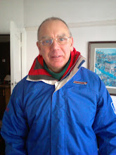
My quest was to walk up Great Whernside (note use of self-timer facility on my camera - I have finally got the hang of how to do it!)

Great Whernside - not to be confused with the better known Whernside, which is some 17 miles to the west – is the highest point of the eastern flank of Wharfedale above Kettlewell and forms the watershed between Wharfedale and Nidderdale.

Great Whernside Trigpoint - Flush Bracket number 2976 - and for those interested in such matters, it is ranked joint 919th (out of some 7,800) in the Triggy Charts


The return to Kettlewell was via Hag Dyke – now the Scout Association’s centre - which is the second highest inhabited building in Yorkshire. Only Tan Hill Inn on the Pennine Way is higher.

My second main walk - again some 12 miles - was to another Trigpoint - Buckden Pike.

This time I headed over Cam Gill, above Starbotton ...

... to the Polish Memorial Cross. The cross is a memorial to five Polish airmen who died when their Wellington bomber crashed on Buckden Pike during a snowstorm in 1942. The sixth crew member survived with only a broken ankle. He followed the footprints of a fox in the snow and managed to crawl to safety. He organised the building of the cross in 1973.

Pen y Ghent in the distance ...

... Buckden in the valley below

Buckden Pike, at 702 metres (2,303 ft) is the second highest peak in the area (Great Whernside is 2 metres higher)

For triggy aficionados, its Flush Bracket number is S5520 and it is ranked joint 1289th in the Triggy Charts.

My route took me back to Kettlewell along the side of the River Wharfe


During my stay I also found time to cycle to Grassington - some 6 miles away


Tom Lee was "notorious" because he murdered a local doctor and threw the body into the Wharfe. Lee was caught and hanged at York in 1766.

Grassington is mostly Georgian in appearance and character although its foundations are considerably older, it grew with the fortunes of nearby lead mining.

However, my main reason for visiting Grassington was to see the Grassington Players' production of Calendar Girls - this was part of their World Amateur Premiere season of performing this play. It was excellent.
Before I left the area, I spent a day in Skipton - but that is a blog entry all on its own
Glad you enjoyed your trip.
ReplyDeleteMiss February of aforementioned production.